Boating New Zealand Boat Reviews
Reviews
Boating New Zealand News
News
Boating New Zealand Sports
Sport
Boating New Zealand Lifestyle
Lifestyle
advertise
Boating New Zealand Boat Reviews
Reviews
Boating New Zealand News
News
Boating New Zealand Sports
Sport
Boating New Zealand Lifestyle
Lifestyle
BOAT-REVIEWS-MOBILE
Boat Reviews
BOAT-NEWS-MOBILE
News
BOAT-SPORTS-MOBILE
Sports
BOAT-LIFESTYLE-MOBILE
Lifestyle
HomeLifestyleWeather forecastSevere weather grips New Zealand’s coasts and catchments

Severe weather grips New Zealand’s coasts and catchments

Published

A powerful low-pressure system is battering New Zealand with torrential rain, embedded thunderstorms, and gale-force winds — sparking widespread weather and marine warnings across both islands. Remember, please: before going out, check with our friends at METservice.com for the very latest weather updates.

Bookmark post
Bookmarked
Bookmark post
Bookmarked

North Island weather: downpours and dangerous winds

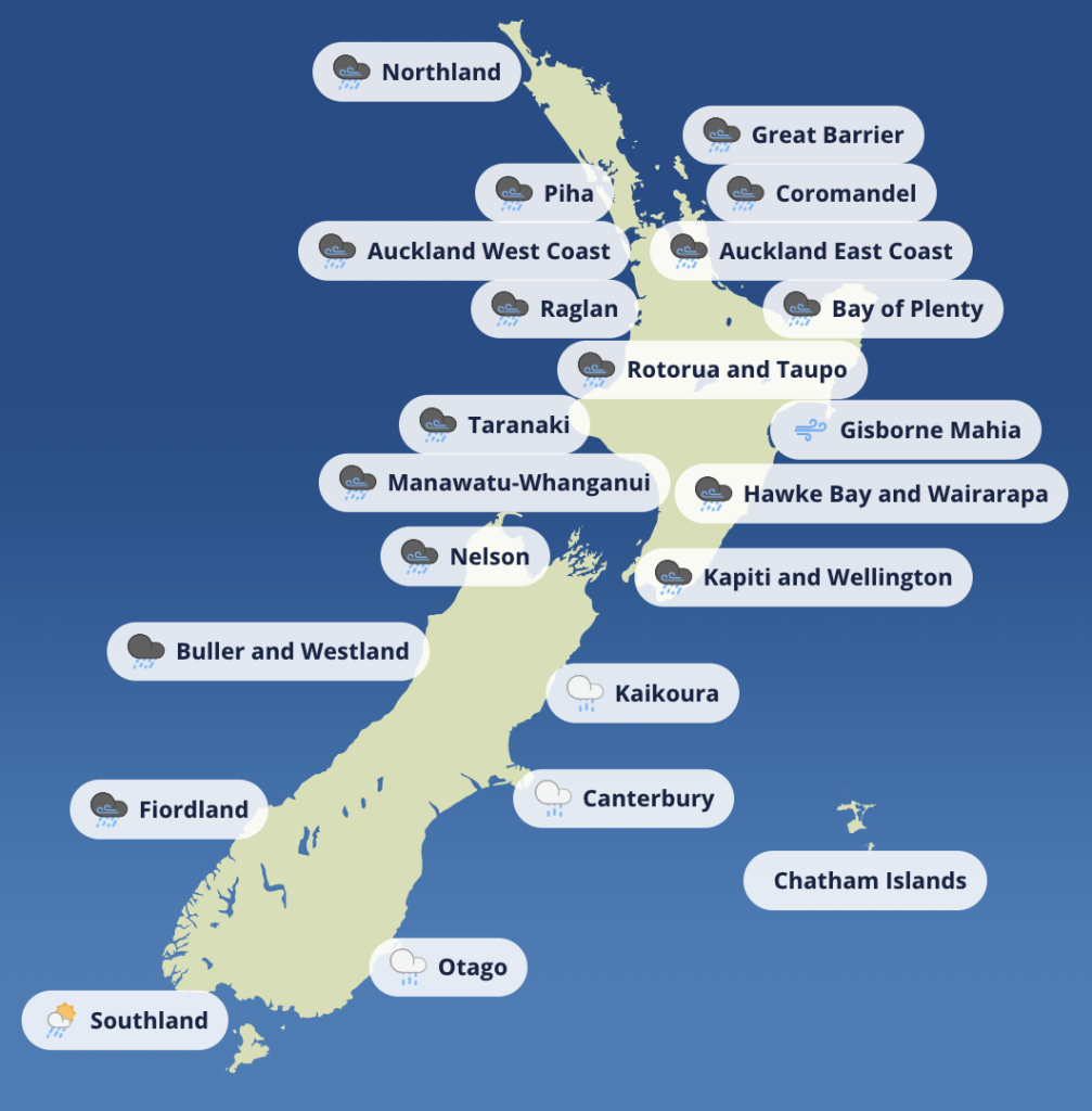
As of Tuesday 29 July, a deep and moisture-laden northeast flow is fuelling heavy rain and unstable atmospheric conditions across much of the North Island. Rainfall rates are expected to peak between 25–40mm/h in many regions, with embedded convection in the frontal system adding the risk of severe thunderstorms from Auckland to Bay of Plenty.

The Coromandel Peninsula is forecast to receive up to 130mm of rain by early Wednesday morning, while the Bay of Plenty could exceed 180mm, especially inland from Kawerau.

“Rainfall of this intensity can cause surface and flash flooding, especially in narrow valleys and stream catchments,” warned MetService in its latest alert.

Across Auckland, Northland, Coromandel and eastern Waikato, the risk extends to slips and sudden stream surges, with Strong Wind Watches in effect as northeast winds push towards severe gale strength in exposed areas. Driving conditions are expected to remain hazardous well into Wednesday morning.

- Advertisement, article continues below -

South Island forecast: front followed by relief

While the North Island bears the brunt of today’s deluge, the upper and western South Island is also in the firing line. Orange Warnings for heavy rain are active across Westland, Tasman, Nelson, Marlborough, Canterbury headwaters and Otago’s alpine rivers.

Rainfall totals of up to 180mm are expected across the Taranaki Maunga, Otago Headwaters and southern main divide, with moderate risk of flooding and slips. However, by late Wednesday, this pattern will begin to shift.

A second front is expected to move north across the South Island, followed by a deep low pressure system forming to the east of New Zealand. This low will usher in a southerly change, bringing colder, showery air up the eastern North Island, while the South Island gradually comes under the protection of a ridge building in from the Tasman.

Coastal and marine conditions: avoid exposed waters

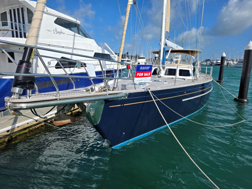
For boaties and coastal users, today’s marine conditions are dangerous in many parts of the country.

Coastal situation, National Map for29/07/2025

A combination of heavy rain, strong winds and reduced visibility is affecting exposed harbours and nearshore areas, particularly in:

- Advertisement, article continues below -
Yacht Sales Company (MHS) logo
1992 Lagoon TPI 42 | Connect 4
AUD $279,000
1992 | 12.94m / 42.60ft | Connect 4 is a proven bluewater cruising catamaran – a 1992 Lagoon 42ft built by TPI Jeanneau – that has journeyed extensively, originally sailing from Turkey through the Panama Canal and across the oceans back to Australia. Since 2012, she has comfortably cruised the east coast of Queensland, with her current owner living aboard in the sheltered waters of Moreton Bay, Brisbane.
  • Auckland and Hauraki Gulf

  • Bay of Plenty

  • Coromandel Peninsula

  • Northland’s east coast

These areas are experiencing heavy onshore rain bands, embedded convective cells, and significant run-off — making river bars unpredictable and inlets surge-prone.

- Advertisement, article continues below -
2003 | Amel Super Maramu 2000 Redline Edition image
2003 | Amel Super Maramu 2000 Redline Edition
36 Degrees Logo
Amel Super Maramu 2000 for sale. Fully equipped, renowned blue-water cruiser, designed to take you on unforgettable adventures up in the islands and beyond!. Enquire today with 36° Brokers, price 245,000
Enquire Now

Later this week, southerly winds will take hold, especially east of Gisborne and the Mahia Peninsula, as a deep low spins up in the east. At the same time, a stabilising ridge is expected to settle weather in southern and western waters.

“Ensure anchorage is secure, check deck drainage, and avoid coastal transits during peak rainfall or wind,” advises the Boating NZ team. “This isn’t a good week for marginal decision-making.”

Regional outlook: what to expect through Saturday

  • Wednesday (30 Jul): Rain and strong winds continue across the North Island; thunderstorm risk eases by night. Front clears the South Island.

  • Thursday (31 Jul): A strong southerly flow hits the eastern North Island; showery, colder air arrives. Two lows dominate offshore weather.

  • Friday (1 Aug): Rain tapers over the North Island; South Island stabilises under a broadening ridge.

  • Saturday (2 Aug): Calmer weather over much of the country as the ridge builds from the Tasman.

Final thoughts: prepare and monitor updates

Boaties, backcountry users, and regional authorities should remain on high alert. With many areas forecast to receive well above warning-level rain totals, and river levels likely to respond quickly, even short outings require extra planning.

For those living or boating in low-lying or flood-prone areas, it’s time to:

  • Clear drains and scuppers

  • Check mooring lines and anchorage

  • Avoid non-essential coastal passages

  • Monitor MetService and local Civil Defence updates

More than a weather watch — this is a system worth taking seriously.

SHARE:

Article
Article

Weather warnings for lower North Island bring heavy swells and strong winds

Weather forecast
Boaties and coastal communities in the lower North Island are being urged to take care, with MetServ...
Article
Article

New Zealand boating weather: a brief reprieve before midweek winds return

Weather forecast
New Zealand boating weather turns unsettled midweek—find out the best spots to boat and which coasts...
Article
Article

Coromandel strong winds: the gusts just kept coming

Incidents at Sea
Boating New Zealand contributor, Kirsten Thomas, tells us of her liveaboard experiences during last ...

Comments

This conversation is moderated by Boating New Zealand. Subscribe to view comments and join the conversation. Choose your plan →

This conversation is moderated by Boating New Zealand.

LEAVE A REPLY

Please enter your comment!
Please enter your name here

Chris Woodhams
Chris Woodhams
Adventurer. Explorer. Sailor.

Aakron Xpress

Need a trailer for your boat?  You’ve come to the right place! We offer Top Quality Boat Trailers and Maintenance Services At Affordable Prices. Largest number of wobble rollers to support and pro...

Hydraulic Steering

So-Pac Marine has over 30 years of experience as both importer and distributor of equipment for pleasure and commercial craft. Our plastic access hatches are widely used in NZ, Australia and the USA. Sales in these markets jump each year and we continue to look for new export markets. Take a look at our new 4000 series hatches, which we claim to be virtually waterproof, now with CE approval. We import some of the best known brands from the US, Europe and Australia, and have long establish...

LATEST NEWS

1972 Delta Delta 36

“Katinka” is a well-maintained example of the 1972 Delta 36, a proven bluewater cruiser with a rich sailing history and robust pedigree.

2005 Haines Signature 600RF

Well-kept, garage-stored family boat with low hours, new carpets, and full gear. Soft-riding foam-filled hull, ideal for fishing or cruising. Regretful sale—owner upgrading. Located in Pauanui with minimal trailer use. Ready for its next adventure—don’t miss out!