A busy day, with weather in the mix
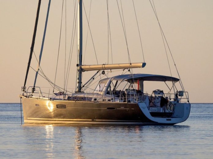
Boxing Day is one of the biggest boating days of the year. Ramps are busy from first light. Beaches fill fast. Anchorages tighten early.
This year, that familiar summer rhythm comes with a clear warning attached.
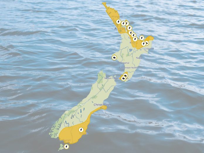
Active Severe Thunderstorm Watches and Heavy Rain Watches are in place across large parts of both islands. While not everyone will see severe weather, the setup is one where conditions can turn abruptly, particularly during the afternoon and evening peak.
For boaties, swimmers and anyone travelling long distances today, this is information worth acting on, not skimming past.
Upper North Island under heavy rain threat
The upper North Island sits first in the firing line.
Northland, Auckland, Great Barrier Island, the Coromandel Peninsula, western Bay of Plenty and Rotorua are under a Severe Thunderstorm Watch through until this evening.
A moist, unstable air mass combined with a complex trough is expected to move east across the region. The main concern is rainfall intensity rather than duration. Short, sharp downpours of 25 to 40 millimetres per hour are possible.
That kind of rain overwhelms drains quickly. Surface flooding builds fast. Visibility can drop to almost nothing in heavy bursts.
For boaties, the risk areas are familiar. River mouths, bars, narrow channels and busy holiday anchorages all become more challenging when rain and wind arrive together. Floating debris and sudden wind shifts are common around thunderstorms.
Heavy Rain Watches are also in place for parts of the Bay of Plenty, Taranaki Maunga, the Tararua Range and Wellington as a front moves north overnight. Some areas carry a moderate chance of escalation to a warning, particularly near ranges.
South Island storms and hail risk
Further south, the hazard profile changes.
Christchurch, the Canterbury Plains and High Country, North Otago, Central Otago, Dunedin, Clutha and Southland are under a Severe Thunderstorm Watch from early afternoon through to 8pm.
A cold, unstable air mass is driving thunderstorm development, especially along coastal Canterbury south of Banks Peninsula, eastern Otago and Southland. There is a moderate risk that some storms become severe.
Large hail is the standout threat, with stones larger than 20 millimetres possible.
Hail of that size can damage vehicles, smash windscreens and make roads instantly hazardous. On the water, hail squalls often arrive with little warning and can flatten visibility in seconds.
If you are anchored in an exposed spot or planning a late return, it pays to reassess early.
What the warnings actually mean
A Severe Thunderstorm Watch means conditions are favourable for storms to reach severe thresholds. It does not guarantee severe weather everywhere, but it does signal a need for awareness and preparation.
In New Zealand, thunderstorms are classified as severe if they produce heavy rain of 25 millimetres per hour or more, hail 20 millimetres or larger, wind gusts exceeding 110 kilometres per hour, or damaging tornadoes or waterspouts.
For most people, the practical takeaway is simple. Watch the sky. Watch the wind. If conditions begin to change quickly, act early rather than waiting to see how it plays out.
Practical advice for today
Keep checking updates from MetService throughout the afternoon and evening. Radar and short term forecasts are particularly useful on days like this.
If severe weather approaches, seek shelter immediately. That may mean heading back to the ramp sooner than planned, shifting to a more protected anchorage, or getting off exposed beaches and headlands.
Driving later in the day may be just as challenging as being on the water. Surface flooding, spray and poor visibility are likely in heavier bursts.
For preparation guidance and safety advice, Civil Defence recommends planning ahead, avoiding flooded areas and staying well clear of fast rising water.


