


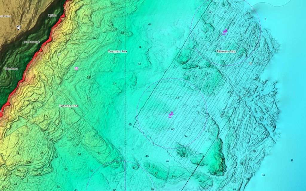
C-MAP®, a leader in marine cartography, has updated it’s charts for Australia and New Zealand, delivering richer detail and improved safety features for boaters and anglers. This update enhances DISCOVER®, REVEAL®, and X Generation charts with improved shaded relief and high-resolution bathymetry, covering selected coastal areas across the Australia and New Zealand.
This update has seen improvements in Western Australia, Northern territory and the NSW coast, as well Auckland, Bay of Plenty and Poverty Bay in New Zealand.
“We’re excited to bring these improvements to our Australian and New Zealand customers,” said Jakob Svensson, C-MAP Product Manager. “Our team remains committed to delivering the most accurate, up-to-date data and continually refining our charts.”

These updates enhance the DISCOVER, REVEAL, and X Generation charts from C-MAP, and are available to both new users and existing customers who purchased a chart within the past year and maintain an active C-MAP subscription. Discover the latest chart data for your region at c-map.com/chartexplorer.
Key Highlights
- Recent Australian updates cover key maritime regions, including Shark Bay in Western Australia, Endeavour Reef in Queensland, alongside the Howard Channel and Beagle Gulf in the Northern Territory.
- New Zealand updates cover the North Island’s Doubtless Bay, Auckland, the Bay of Plenty, and Poverty Bay. In the South Island, updates include the Nelson region’s Trafalgar Point and Delaware Bay, as well as the Foveaux Strait in the far south.
- Official hydrographic office data to enhance navigational data across all technologies and SKUs within the APAC region.
Shaded Relief is exclusive to C-MAP Reveal and Reveal X and are available on a range of chartplotters from the Lowrance®, Simrad® & B&G® brands. For a detailed look at the enhancements and enriched chart content in this update, explore our interactive story map, and for more information on C-MAP and its latest cartography offerings, please visit c-map.com.

