What’s happening right now
A slow-moving front is parked over the northeast of the North Island and going nowhere fast. The humid northeast flow it’s dragging with it means persistent, heavy rain across a wide area — and for boaties, the water is already a mess.
An Orange Heavy Rain Warning is in force for Bay of Plenty west of Whakatane, including Rotorua, until 9pm tonight. Expect 60 to 80mm on top of what’s already fallen, with bursts of 25 to 40mm per hour possible in the worst of the downpours. There’s a small chance this gets bumped to Red before it clears.
Heavy Rain Watches are also running for the Coromandel Peninsula, Waikato, Waitomo, Taumarunui, Taupo and eastern Bay of Plenty through today and into Thursday — one step below a full warning, but worth taking seriously.
Out on the water it’s already nasty across the upper North Island. Coromandel is sitting under northeast winds gusting to 35 knots, rough seas and very poor visibility in heavy rain. Bay of Plenty has a Strong Wind Advisory with northeast winds gusting to 35 knots and swells running at 2.5 metres. Castlepoint carries a Gale Warning — northeast 35 knots, very rough seas. Puysegur is also under a Gale Warning today.

Expect rivers to rise quickly. Surface flooding, slips and treacherous driving conditions are all on the cards across warned areas.
Cyclone Vaianu — the big picture
This is the one everyone needs to watch. Severe Tropical Cyclone Vaianu is a category three system sitting roughly 380km south-southwest of Nadi, Fiji, heading south. It’s already hammered Fiji and has New Zealand squarely in its sights.
MetService Meteorologist John Law flagged the seriousness early — issuing a Severe Weather Watch days ahead of when they’d normally do so. That early call is itself a signal of how significant this system could be.
Vaianu is forecast to shed its tropical characteristics on Friday and transition into an extra-tropical cyclone before tracking south-southwest toward New Zealand over the weekend. MetService takes over official forecasting for the system when it crosses 25°S, expected sometime Thursday morning.
What Sunday looks like
A Strong Wind Watch covers the entire North Island from 1am to 11pm Sunday 12 April. The winds, if Vaianu tracks as expected, could be damaging and in some places life-threatening — alongside heavy rain and rough coastal conditions across much of central and northern New Zealand.

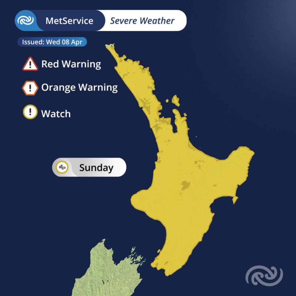
Parts of the Watch are expected to be lifted to Orange Warnings, with some areas possibly hitting Red, as the track firms up over the next few days. Heavy Rain Watches and Warnings tied specifically to the cyclone are likely to land Thursday.
Where the worst of it hits — fallen trees, power cuts, flooding, slips, road closures and cut-off communities — comes down to exactly where Vaianu tracks. That picture will sharpen over the coming days.
What this means for boaties
Don’t lock in any plans on the water this weekend without checking the latest forecast first. Saturday is already shaping up as rough across the north and east, with heavy rain and southeasterly gales expected to develop in Northland by Saturday evening.
Sunday is a different level entirely. Gale southeasterlies are forecast across most of the North Island, swinging to gale southwesterlies as the system pushes through. The coast will be hazardous. Stay ashore.
The northern and western South Island is also in for a hiding, with heavy rain likely and conditions deteriorating through the day.
How to stay across it
MetService will be updating forecasts regularly as Vaianu closes in. Check metservice.com often, get the MetService app on your phone and turn on notifications for Severe Weather Warnings in your area. For what to do before it hits, getready.govt.nz is the place to start.
Warnings and watches can change quickly. Check metservice.com before you head out.