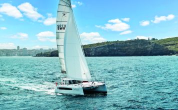
PredictWind – one of the world’s most popular wind/weather forecasting apps – was once the exclusive domain of sailors. But a growing number of power boat owners are now embracing the technology. Story by Lawrence Schäffler.
Launched around 15 years ago by Auckland’s Jon Bilger, PredictWind is a subscription-based global wind/weather forecasting service – accessed via a phone/tablet/laptop app. With various ‘feature levels’ corresponding to a tiered price structure, it now has more than a million users worldwide.
Getting to this point, says Bilger, has been quite a journey.
A mechanical engineer, Bilger is also a former America’s Cup sailor with decades of successful dinghy and keelboat racing experience (underscored by numerous national titles). Inevitably, second-guessing the vagaries of the wind became embedded in his DNA.
During his AC tenure as Weather Team Manager with Alinghi (2003 – 2010) he began mulling over the possibility of adapting the weather/wind data used by professional sailors – and packaging it for club and recreational sailors in an easy-to-use format. PredictWind’s ‘cat’s paws’ began to form.
“I knew there had to be a way to integrate satellite technology and GPS with existing weather forecasting models and reasoned such a marriage could (and should) be made available to sailors anywhere in the world – in real time. I just didn’t appreciate how difficult it would be.”

He approached the gurus at Australia’s CSIRO (Commonwealth Scientific and Industrial Research Organisation) about using its existing weather forecast modelling technology as the basis for his idea. “Remarkably, they committed to the concept – even though my ‘business’ track record was virtually non-existent. I was very fortunate – and PredictWind was born.”
Today the company employs around 50 staff in various parts of the world and has evolved into a service that embraces weather forecasting and routing, passage planning, monitoring coastal and oceanic currents – and even anchor alarms. For optimum accuracy it synthesizes the data from six global weather forecast models.
And where the initial focus was the professional/competitive sailing fraternity, PredictWind now reaches a far broader audience – recreational club sailors and blue water cruisers among them – as well as non-marine users.
“In fact,” says Bilger, “our users include sectors we’d never considered – the construction industry, for example. There are quite a few building crews who use the app to minimise risk when ordering and pouring large volumes of concrete.
“We also discovered it was widely used during Japan’s 2011 earthquake. Locals were very concerned about the fallout from the damaged Fukushima nuclear plant – and wanted to know which way the wind would be blowing.”
But perhaps the most intriguing part of the technology’s expanding user base is its growing popularity among launch owners.
Talking to satellites
Boats in marinas or close to land have easy access to WiFi and the internet, allowing skippers to download weather forecasts. But weather is rarely static and forecasts can become inaccurate within hours. To access updated models (when you’re over the horizon, beyond the reach of shore-based internet services) typically requires talking to satellites.
A PredictWind subscription provides this connectivity through its association with the Iridium satellite network and, more recently, with Elon Musk’s Starlink constellation. This allows users – anywhere on the planet – to download weather data and integrate it with onboard instruments.
But the app offers a lot more than weather data and forecasts. A quick online analysis of user reviews/experiences indicates that in addition to the appeal of accurate, up-to-the-minute forecasts during long passages, one of the most favoured features is helping skippers to plan passages.
Specifically, timing a departure around the most favourable weather window, as well as selecting the best route. These receive a big tick from both yachties and power boaters.

For yachties, knowing what the wind/weather will be like mid-ocean in 10 days’ time is, of course, directly related to how a boat performs on different points of sail, in different wind conditions, with different wave heights/patterns.
If you know, for example, that your boat averages seven knots on a beam reach in 15 knots of wind, and perhaps five knots close-hauled, it’s relatively easy for PredictWind to project where you will be in 10 days’ time for a given wind/weather scenario.
A yacht’s performance characteristics on different points of sail and in various wind strengths is known as its POLAR data. A theoretical framework, a POLAR is calculated from parameters such as displacement, length, beam, waterline length and sailplan. It’s typically provided by yacht manufacturers – but the data can also be entered by skippers who know their vessel well.
POLAR data – coupled with a reliable, extended forecast – means PredictWind not only suggests the optimum departure time for a voyage, but also provides various options (and a recommendation) for the best route. The fastest route might not be the most comfortable.

Power boats
Launch skippers receive the same service for planning long-distance (coastal or offshore) voyages, though it’s based on slightly different information.
“For power boats,” says Bilger, “the algorithm is geared to minimising drag and reducing resistance – and that translates into better fuel efficiency.” Rather than a yacht’s POLAR data, PredictWind bases its calculations and recommendations on a hydrodynamic model of the power boat’s hull shape – whether it’s a monohull, cat or trimaran.
The calculations factor in the vessel’s most efficient cruising speed and balances this against forecast weather conditions – wind strength and direction, certainly, but also wave patterns. Waves can be complex phenomena – with primary, secondary and tertiary swells all running in different directions.
As with yachts, the most direct route might not be the fastest or most comfortable. PredictWind offers skippers the luxury of choice.
“The algorithm not only predicts your speed for the forecast conditions, but also how much slamming, vertical acceleration and roll the crew’s likely to experience. A 4o or 5o roll can be very uncomfortable – particularly on a flybridge. Vertical acceleration is a good indicator of potential seasickness. The higher the acceleration, the more likely the crew will be affected.”
And if you don’t have a hydrodynamic model for your boat? That’s easily catered for in the app. “The user enters the vessel’s length, beam and displacement, and the app works it out. It’s not absolute or precise – all boats are different – but it delivers a very clear idea of a vessel’s likely performance in different conditions.”
A growing number of power boat skippers agree.

Evolution
To stay ahead of the curve, says Bilger, PredictWind has evolved continuously – introducing new technology that provides meteorological data in higher, crisper resolution (and at faster speeds) – with added layers of service.
The recently-launched PredictCurrent, for example, tracks the currents that operate in the planet’s oceans and around its coastlines. A land mass affects local currents and wind, and being forewarned about a current-against-wind scenario is a useful bit of information to digest when planning your departure.
Another recent addition is Over the Horizon AIS. Like VHF radio, AIS is limited by ‘line-of-sight’ and can only identify vessels and their headings in relatively close proximity. Over the Horizon AIS uses satellites and, as the name suggests skippers are alerted about vessels on a collision course far earlier.
Then there’s Anchor Alert – a feature which lets skippers (on board or remotely) know that their vessel is dragging or drifting.
Which product?
PredictWind is a tiered subscription service with four levels. The entry level is free but has relatively limited features and can only be accessed with access to WiFi and land-based internet. Next up are the Basic and Standard packages offering proportionately more – including access to satellites – while the Pro package comes with all the bells and whistles.
Visit the website to explore the options – and expect to pay between US$250 and US$500 annually for the upper-level packages.
Committed blue water cruisers tend to be a frugal bunch and might baulk at this but, as always, context is everything. As a percentage of the vessel’s annual running costs – perhaps $500 a year is not too onerous – particularly with the added safety factor.

The best form of seamanship – says Bilger – is not getting into bad weather if you can avoid it. Those odds are lengthened considerably with reliable, up-to-the-minute weather data.
In more than 30,000 miles of blue water sailing (a long time ago) I can confirm that my trans-ocean departure dates where usually shaped around an antifouling or the arrival (finally!) of a spare Jabsco toilet kit.
In many cases knowing the shape of the weather would have made the passage a lot easier.
SIX IN ONE
PredictWind, says Bilger, is obsessive about giving users accurate, up-to-date data – and to achieve that goal it blends six global weather forecasting models and averages the data.
Each model has benefits and features. Some have better resolution; others have greater computer processing power or use a more extensive satellite network. Many use the data from the same satellites, aircraft, weather buoys and meteorological stations, but interpret it differently.

The six models are:
ECMWF – the European Centre for Medium-Range Weather Forecasts is an independent intergovernmental organisation supported by most of the nations of Europe.
SPIRE – a satellite constellation using radio frequency sensors to create a 3D profile of atmospheric temperature, pressure, and humidity over 10,000 times per day.
UKMO – the UK Meteorological Office’s model is used by many Met Offices and weather companies around the world.
GFS – the Global Forecast System model is the most widely-used data source as it’s free. Though a good model, it has a lower accuracy than other models.
PWE – the first of PredictWind’s exclusive global models, PWE uses the ECMWF global initial conditions for the model run.
PWG – PredictWind’s second exclusive global model, which uses the NCEP (GFS) global initial conditions for the model run.


