A sudden shift after a frosty calm
After a string of cold, clear days and record-setting morning frosts across the motu, Aotearoa is poised for a weather change this weekend. A high-pressure system has dominated the skies, bringing stable and chilly conditions. But by late Saturday, a broad trough from the Tasman Sea begins to push through, dragging with it rain, wind, and rising temperatures.
MetService meteorologist Devlin Lynden warns that the ridge is on the move:
“We can enjoy the clear days for a little bit longer. But that ridge is on the move, and we’ll start to feel the effects as early as Saturday in the south.”
By Monday, much of the country is likely to experience rain, strengthening northerly winds, and a noticeable increase in overnight temperatures. Heavy falls are possible for parts of Northland, the West Coast, and Tasman District, with watches or warnings potentially issued by early next week.
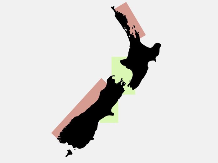
Marlborough Sounds and Cook Strait is the place to be
For those heading out on the water, the place to be this weekend is the upper South Island — particularly the Marlborough Sounds and surrounding Cook Strait inlets. Forecasts show continued fine weather and light winds through Sunday, with manageable swell conditions and clear visibility.
- Wellington, Mana, Kapiti: Calm days, smooth seas, and gentle northerlies.
- Christchurch: Light winds and mostly fine skies throughout the weekend.
- Marlborough and Nelson regions: Dry conditions linger the longest here, with rain not expected until late Monday.
These areas offer some of the last of the midwinter stillness — ideal for a relaxing motor cruise, a weekend of sailing, or a scenic trip to the Sounds before the weather turns.
Show caution in Northland, Coromandel and the West Coast
Boaties looking for action should show caution in Northland and the West Coast of the South Island, where the change arrives first and hardest.
- Bay of Islands and Bream Bay: Northeast winds build steadily from Saturday, reaching 25 knots by Monday, with swell increasing to 3 metres.
- Hauraki Gulf and Coromandel: Expect increasing chop, rising swell, and the first showers by Sunday night.
- Fiordland and West Coast: Cloud and scattered rain arrive from Friday evening, with heavier falls likely through Monday.
These regions face challenging conditions as the weather deteriorates — gusty winds, building seas, and reduced visibility could make for an uncomfortable or unsafe trip, especially for smaller craft.
Summary
If you’re thinking of heading out, make the most of Friday and Saturday, particularly in sheltered eastern and central regions. By Sunday afternoon and into Monday, plan for rising wind and seas, especially in the north and west.
Stay up to date with the latest marine and recreational forecasts at metservice.com and heed any updated warnings or watches.


