


Marine and coastal conditions
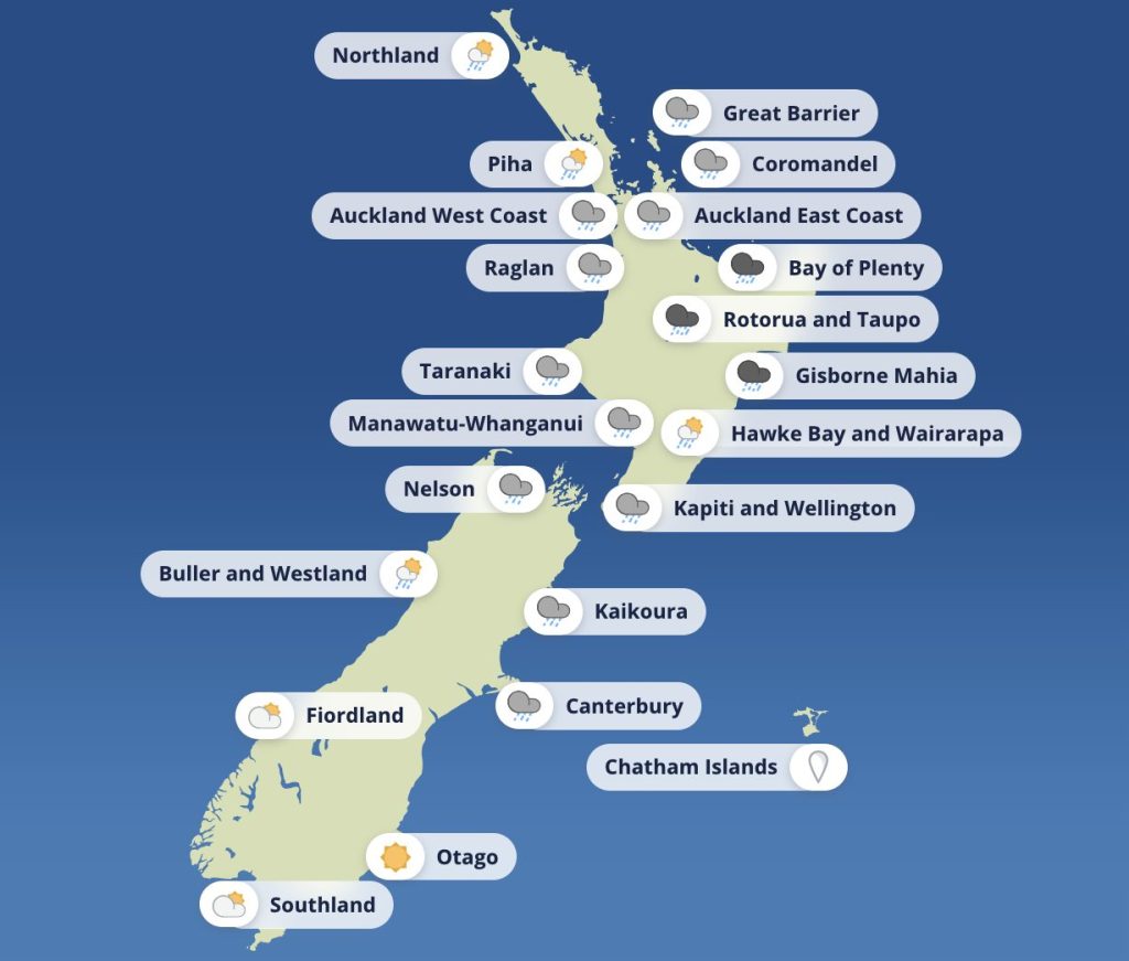
A broad trough sits over northern and central New Zealand today, delivering rain, low cloud and reduced visibility. A ridge brings gradual improvement tomorrow, but conditions today remain unsettled across many harbours and exposed coasts.
Waitematā Harbour
- NE 20 knots gusting 30, easing to 15 knots this morning
- Turning NW 10 knots this evening
- Moderate sea easing
- Poor visibility in rain, shifting to showers later
Manukau Harbour
- NE 10 knots turning NW 10 this afternoon
- Slight sea
- Poor visibility in rain
- West coast swell: W 1 metre
Wellington / South Coast
- Northerly rising to 20 knots this afternoon
- Sea becoming moderate
- Occasional rain and reduced visibility
- Castlepoint: NE swell 2 metres
Christchurch
- NE 20 knots easing to variable 5 this morning
- Easterly 15 knots developing this afternoon
- Seas easing
- Fair visibility in patchy rain, clearing later
Coromandel coastal waters
- Strong Wind Advisory
- N 25 knots gusting 35, easing to 15 knots this morning
- Turning NW 10 this afternoon
- NE swell 2 metres, easing
- Visibility poor in rain, easing to showers
- Wider weather situation and warnings
A humid northeasterly flow and a weakening frontal system are driving widespread heavy rain for much of the upper North Island today and into Wednesday. The front weakens overnight, but not before delivering significant rainfall totals. A ridge builds through Thursday and Friday, improving conditions.
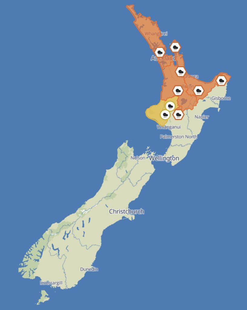
Heavy Rain Warnings – Orange
- Northland, Auckland and Great Barrier Island
- Midnight Tue – 2pm Wed
- 80–100 mm, isolated downpours 25–40 mm/h
- Low chance of upgrade
Impacts: Rapid river rises, slips, surface flooding
Coromandel Peninsula
8pm Tue – 3pm Wed
- 120–150 mm, heaviest on higher ground
- Downpours 25–40 mm/h
Impacts: Flooding and slips likely on coastal roads - Waitomo, Waikato and Taupō
10pm Tue – 6pm Wed
- 70–110 mm, heaviest in the east
Impacts: Rivers respond quickly; morning travel disruption likely
Bay of Plenty
10pm Tue – 11pm Wed
- 140–180 mm, heaviest west of Whakatāne
Impacts: High slip risk; rapid stream rises
Gisborne north of Ruatoria
6am – midnight Wed
- 100–120 mm, peak 25–40 mm/h late morning and afternoon
Tongariro National Park
1am – 10pm Wed
- 100–140 mm, with intense downpours possible
Heavy Rain Watches
Taumarunui and Taihape: Moderate chance of upgrading

Taranaki: Heavy rain possible, but less likely to upgrade
And for the rest of the week
Thursday: Ridge settles over most of the North Island, easing conditions.
Friday–Saturday: Weak front brushes the upper South Island and Westland.
Sunday: Strong ridge across both islands; a weak trough lingers near the Far North.
 Wellington is shown below.")

