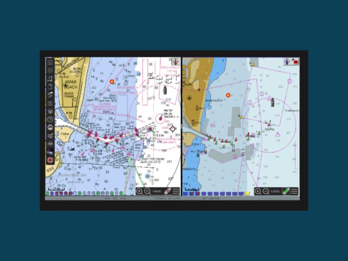
Since its introduction in 2008, OpenCPN has grown from a cruiser’s personal project into one of the most widely used open-source navigation tools afloat. It was conceived by a full-time sailor who wanted a fast, no-nonsense chartplotter optimised for real-world use at the helm.
At its core, OpenCPN is a chart plotter and GPS navigation program designed to run continuously while underway. It works on everyday computers — Windows, Linux, macOS, even Raspberry Pi — and is equally at home on a yacht’s nav station, a powerboat’s flybridge, or a small expedition vessel. The program plots your position using GPS data, displays official raster (RNC) and vector (ENC) charts, and supports a range of industry standards including S-57, S-63, InlandENCs, and BSB formats.
One of its defining features is modularity. OpenCPN’s plugin architecture lets users add functions from weather routing and GRIB overlays to AIS target tracking and collision alarms. More than 45 plugins are available, covering everything from tide and current predictions to autopilot control. The software also integrates route, track, and waypoint management, with import/export in GPX format for use across devices and platforms.
OpenCPN is a working navigator. Its “quilted” chart display stitches multiple charts together seamlessly, while display modes allow north-up, course-up, and head-up orientations. Built-in alarms can warn of dragging anchors, MOB (man overboard) events, or approaching AIS targets. For inland waterways, it even supports Inland ECDIS 2.3 standards.
Because it’s open-source under the GPLv2 licence, the program is free to download and modify. This openness has fostered an international development community that responds quickly to bugs and user requests. Documentation, a detailed user manual, and an active forum help new users get up to speed.
Accuracy, as with any ECS (Electronic Chart System), depends on both the GPS input and the quality of the chart data. OpenCPN can typically plot a vessel within about 30 metres of its true position — in line with commercial systems — but still relies on the skipper’s eyes and seamanship.
From tiny screens on tiller-steered yachts to networked workstations aboard trawlers, OpenCPN’s flexibility and low resource demands have kept it relevant. It’s used for coastal cruising, offshore passagemaking, and even as a planning tool ashore.
In short, OpenCPN remains what its creator intended: a concise, robust, and practical navigation platform — shaped by those who use it, and still at the helm after more than 15 years.


