It was a slow sail back from Whangarei. That gave us an opportunity to anchor overnight at Leigh. It was worth it.
A shipmate, far wiser than me, has the opposite view than mine of voyaging under sail. While I might boast about how fast I might have got somewhere, Rob will instead emphasise the virtues of the ‘slowest possible passage.’ Which stands to reason – even I can see that: more time on the water, more unhurried appreciation of the stopovers and sights along the way. More philosophy en route. Kinda like slow food for the soul. And of course we all need that.
So when I was sailing with Bill back from Whangarei on Skyborne after her maintenance haulout, (he’s also a slow trips aficionado, and with a penchant for even wider detours), the settled weather was just fine by us.
Zephyrs from Whangarei Heads southwards, meant our day’s sailing only got us as far as Leigh. All good for me, as for a while now, I’ve been wanting to stop in there for an Up the Creek adventure.
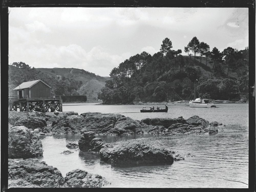
I remembered the small harbour well, from the times we would drop our daughter Zoë off for boat taxi trips to nearby Hauturu Little Barrier Island, when she was doing her MSc studies there considering kākāpō on the island. But we’d never anchored there ourselves.
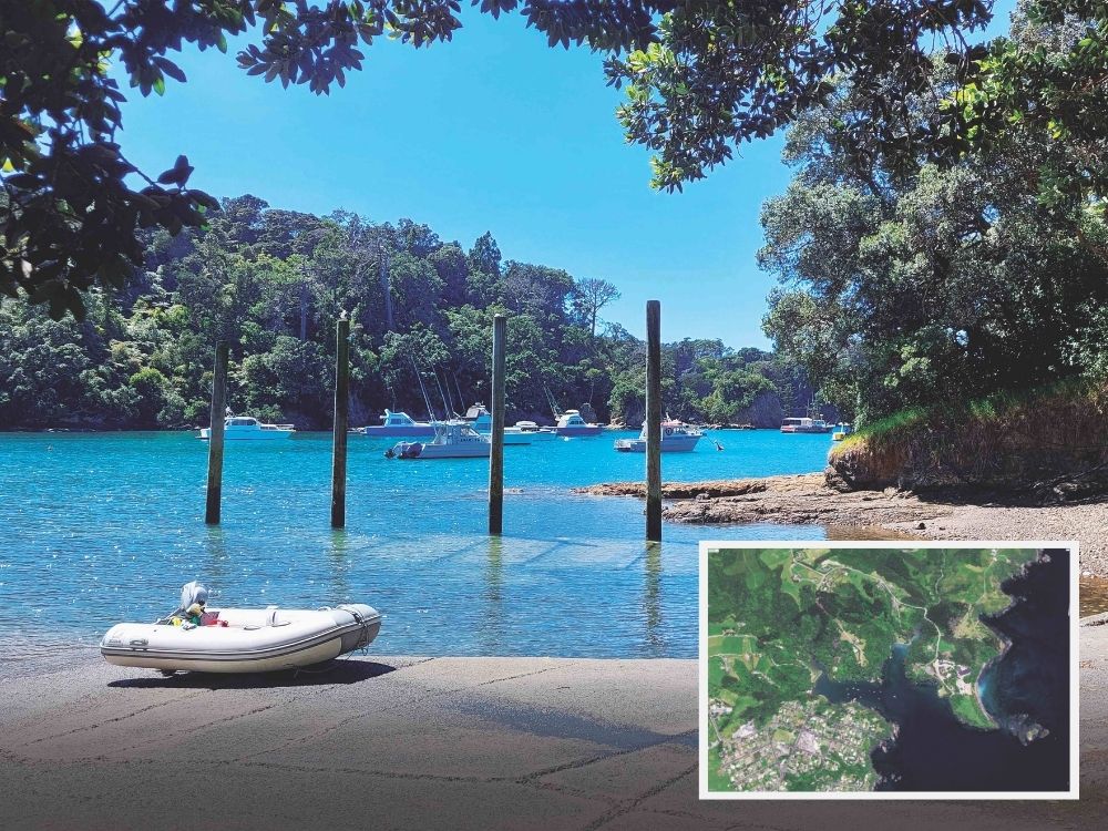
It’s a modest-sized inlet at Leigh, and one almost filled with moorings for a fleet of small commercial fishing boats. It’s also filled with history. Still, there is space to safely anchor a few more yachts.
Traditionally known as Ōmaha Cove, Leigh was re-named in 1858 after the Wesleyan missionary Rev. Samuel Leigh, who visited the area.
Indigenous history is provided by the website of Ōmaha Marae, which sits atop the northern headland of the inlet:

‘The Omaha Pā (Marae) is situated at Little Omaha (Waikowhai) and was the original kāinga for our Tupuna – Te Kiri Patuparaoa raua ko Pepei. Later the home of Rahui raua ko Tenetahi. It is also the place where our Tupuna rest in peace in our Wahi Tapu at Te Waikowhai.
‘In times past the mana of Ngāti Manuhiri spread from Te Paepae-o-Tūmatauenga (Bream Head) in the north to Whangapāraoa in the south. Te Paepae-o-Tu is a Pa site at Te Mangawhai. Te Urunga and his Teina Te Kiri Patuparaoa were firm in their identity as Te Kawerau, Ngati Manuhiri and Te Uri-o-Katea (Hapu). They never acknowledged any other iwi or hapu.
‘Prior to the arrival of the descendants of Tua (Whātua), Ngāti Manuhiri as part of the confederated hapu of Te Kawerau, together with Ngāi Tāhuhu, were the kaitiaki of the lands which are now referred to in part as the Rodney District. To our north lived our related hapu of the descendants of Te Ruangakau (Uri-o-Ruangakau) at Mangawhai and Te Arai, at Pakirikiri and Waikowhai, the descendants of Te Awa (Uri-o-Awa), and to the south the descendants of Te Marohiro (Uri-o-Marohiro). Southward to Tawharanui and beyond, Ngati Raupo, Ngati Rongo, Ngati Kahu, Ngati Ka, and Poutaniwha.’
A later settler’s point of view is added by Some Material on the History of Leigh from the papers of CS Clarke. (Charles Septimus Clarke, a larger-than-life character himself – see info panel)
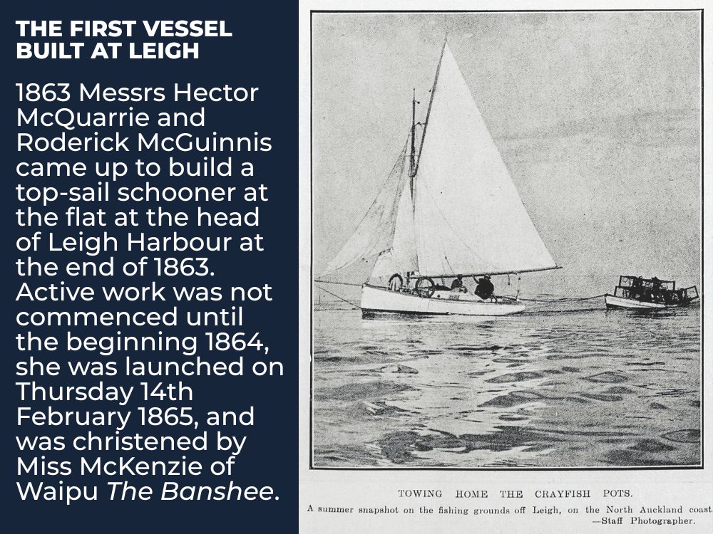
The first vessel built at Leigh
1863 Messrs Hector McQuarrie and Roderick McGuinnis came up to build a top-sail schooner at the flat at the head of Leigh Harbour at the end of 1863. Active work was not commenced until the beginning 1864, she was launched on Thursday 14th February 1865, and was christened by Miss McKenzie of Waipu The Banshee.
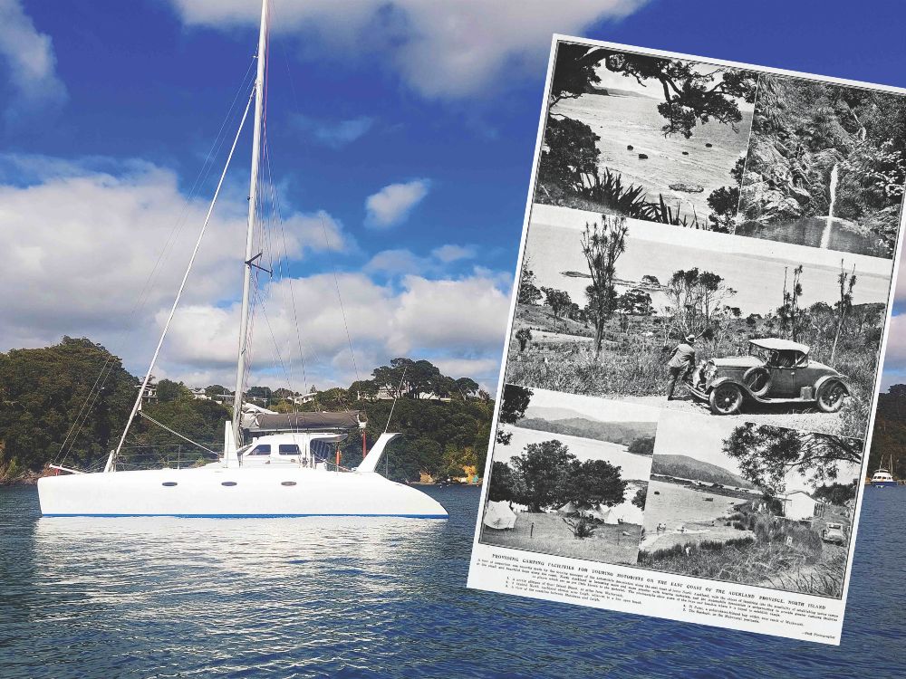
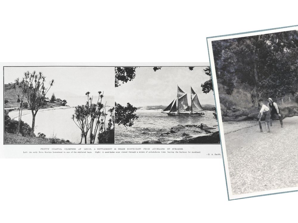
‘Omaha harbour is a snug little cove sheltered from the northerly gales, by the Maori point and island, but exposed to the SE winds, the water is deep so that vessels can remain at anchor in safety at any state of the tide. The land around the harbour at one time beautiful bush, pohutukawa trees growing right down to the water’s edge, the latter were cut down in the early days for knees of vessels.
‘The first [European] survey of land for settlement was made by Messrs Heaphy & Baber in about the year 1858.

‘The natural growth was generally mixed bush, rimu, puriri, tawa, tairaire, rata, riwariwa, manuka, etc. – with an undergrowth of ferns, nikau and supplejacks.’
‘The first settlers to come to Omaha were from Nova Scotia. Many families left Nova Scotia in the early 50s in search of a more salubrious climate than the one they had left to settle in. On the 1st October 1850 the Margaret left St Anns, Nova Scotia with several families accompanied by their Minister (Revd Norman McLeod). Bound for Australia and Auckland, she was followed by the Highland Lass which left Cape Breton on 17th May 1852, she should have left the previous Jany [January] but was frozen up at that time, she proceeded to Symond’s Town South Africa where she staid 3 weeks on account of sickness on board, she then proceeded to Adelaide, South Australia coming eventually to Auckland. The names of the other vessels bringing emigrants from Nova Scotia were the Gertrude, Sprey which arrived in Auckland in 1857, the Ellen Lewis and the Bredalbane. Most of these families settled at Waipu – some at Whangarei and the following families settled at Omaha, Duncan Matheson and Angus Matheson in 1859, Kenneth McKenzie, Kenneth McKenzie (Red Kenneth) Duncan Kempt, John Kempt, Alexr Kempt Senr & Jnr, Gregor Kempt and Angus Stewart from Prince Edwards Island all came to Omaha in 1860.
‘The late Mrs Duncan Matheson Senr then Miss Finlayson came out in the Highland Lass, the Matheson and the McKenzie families in the Sprey, and the Kempt families in the Ellen Lewis.’
Septimus Clarke adds some provisioning notes: ‘Flour in those early days was very dear, 32/6 per 100 lb bag so several of the settlers commenced to grow wheat. After the bush was burned off and logged up, the ground was broken up with strong hoes and wheat sown on the surface and chipped in, being new ground good crops were obtained it was cut with a reap hook, winnowed in the wind, and ground into flour in a steel mill turned by hand and rubbed through a sieve before a loaf could be made, the bread was very wholesome but like the bread made from silk dressed flour. Mr Wyatt being of an ingenious nature made a windmill to turn the steel mill, the mill house was mounted on 4 wooden wheels running on a smooth circular track, so that the sails could be turned to face the wind. This was an object of interest as many young people came to gaze at it with wonder not having seen anything like it before.
‘Pigeons were very plentiful in those early days as a lot of the bush was then standing, they were feeding on the tawa and tirairie berries, and it was no uncommon thing for a person to go out shoot 20 in a morning, they were very plump and fat, and the fat had often to do for butter on our bread.’
To the present
The breeze stayed light (non-existent). The sun was out. Bill and I spent the best, leisurely day exploring the two creeks flowing into the harbour at Leigh – both intimate, and available to explore in kayaks for only a half-kilometre or so. For the LH creek, you need to get half tide to be able to duck under a low bridge. For the RH creek, up past Valhalla the Danish Society house, high tide is necessary to traverse a shallow sandflats bay and still involves a duck under the bridge carrying Omaha Block Access Road, leading to the Danish property and the marae.
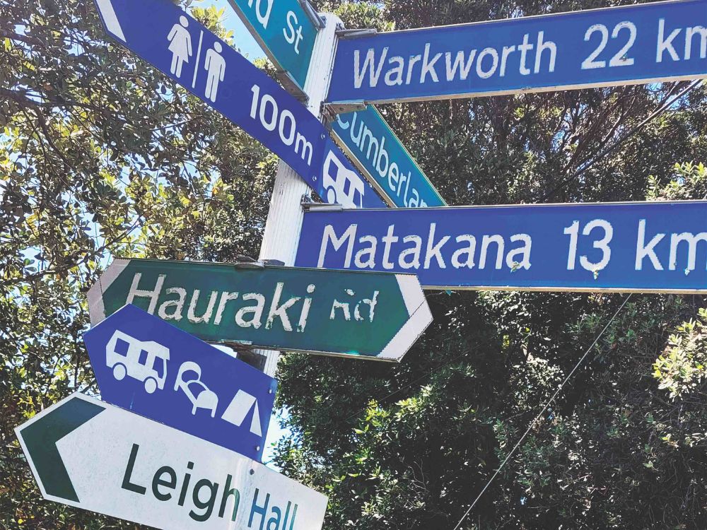
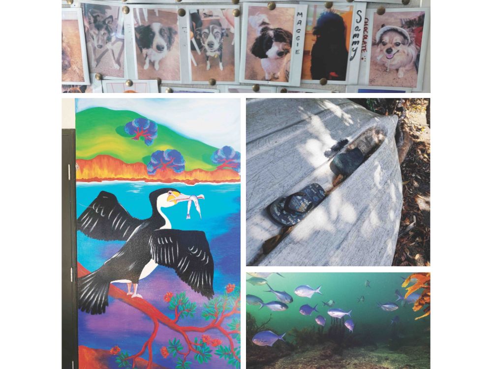
We went ashore at the public slipway just by the fishing boats wharf, and strolled around the town. Naturally we had to visit the charming, compact rural library and get a seafood snack at the famous Leigh Eats. I was most impressed with the wall display of photos of friendly dogs, also considered valuable clientele for the famous takeaways/restaurant. Good ol’ fashioned Polaroid snaps, some faded to show what long-term customers they are. The folk there tell me it was a tradition started by previous owners, one which they are happy to perpetuate. We will have to return with our new dog Belle accompanying us.
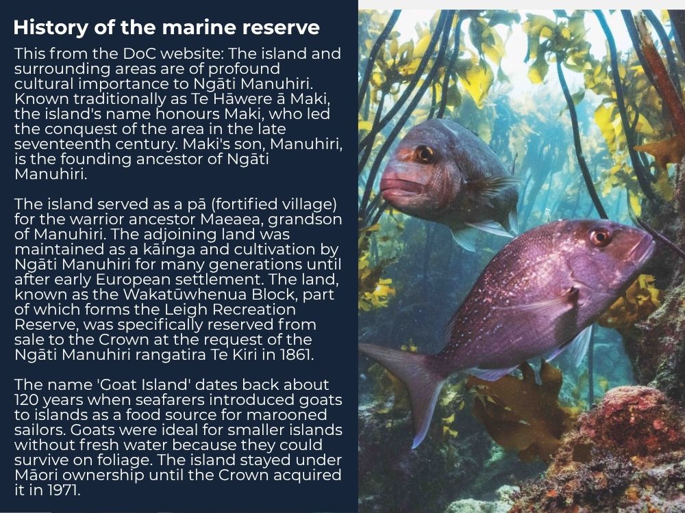
History of the marine reserve
This from the DoC website: The island and surrounding areas are of profound cultural importance to Ngāti Manuhiri. Known traditionally as Te Hāwere ā Maki, the island’s name honours Maki, who led the conquest of the area in the late seventeenth century. Maki’s son, Manuhiri, is the founding ancestor of Ngāti Manuhiri.
The island served as a pā (fortified village) for the warrior ancestor Maeaea, grandson of Manuhiri. The adjoining land was maintained as a kāinga and cultivation by Ngāti Manuhiri for many generations until after early European settlement. The land, known as the Wakatūwhenua Block, part of which forms the Leigh Recreation Reserve, was specifically reserved from sale to the Crown at the request of the Ngāti Manuhiri rangatira Te Kiri in 1861.
The name ‘Goat Island’ dates back about 120 years when seafarers introduced goats to islands as a food source for marooned sailors. Goats were ideal for smaller islands without fresh water because they could survive on foliage. The island stayed under Māori ownership until the Crown acquired it in 1971.
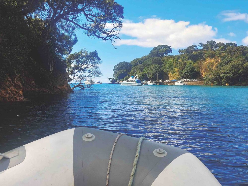
World famous
Leigh is firmly fixed in the minds of New Zealanders – and international visitors – as the locality associated with the nearby Goat Island Marine Reserve. Though the reserve’s official name, Cape Rodney–Okakari Point (Leigh) Marine Reserve – is hardly remembered. It’s also known as the Te Hāwere-a-Maki. And since its establishment in 1975 (the first marine reserve in New Zealand and possibly the world) the fortunes of the reserve and the town have been linked.
Beyond their conservation value, marine reserves are of enormous benefit economically – see www.sciencedirect.com/science/article/abs/pii/S0308597X21004036.
It has been demonstrated that 11% of all the snapper in the Hauraki Gulf Marine Park are recruited (hatched from eggs) in the reserve at Leigh which makes up less than 1% of the area of the Hauraki Gulf and shows that marine reserves are far and away the most effective marine protected areas. They hold 670% more biomass than unprotected waters and more than double that of the next most effective MPA (Marine Protected Area – of which there are five types). Put simply, this is more than six times as many fish in the sea.
We will all benefit from this – including recreational fishers – for marine reserves have no fences, and all have a positive spill-over effect. Currently, the area of marine reserves remains way too small for the recovery of biodiversity of the Huaraki Gulf to be achieved.
According to an article in The Conversation, ‘About 350,000 people visit the reserve annually, mostly to snorkel, dive or take a glass-bottom boat trip to explore the abundance of life beneath the waves. A lot more places could look like this marine reserve if we managed our oceans better.’
Out on the rocks
Daniel’s Reef, one of the best of many nearby surfing spots, was named after a local surfer, Adrian Rogers. But why Daniel? Adrian’s nickname was Daniel Boone as he always wore a hat.
History of the town
A sawmill was established at the head of Leigh Harbour with most timber transported by sea. In 1939 it was re-located alongside Pakiri Road; and then was purchased by the Guinness Family in 1994. This became Leigh Sawmill Cafe opening in 1996.
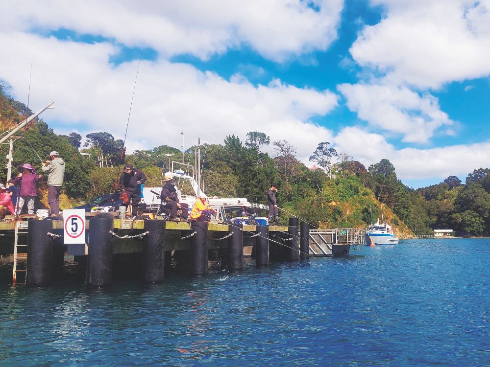
The Local info website has more: ‘A jetty was built in Leigh Harbour and railway lines ran from the quarry to load scows at high tide. The quarry shut down in 1930. Coastal steamships brought day trippers from Auckland to local events such as the Leigh Show, disembarking at the Leigh Wharf. The wharf has been upgraded over the years and services commercial fishermen unloading their catch or filling up with ice. Dive charter boats also load divers and nearby is a small boat ramp.
‘The Jolly Fisherman’s Lodge at the head of Leigh Harbour was built in the early 1900s and has now been restored. It was used as a holiday place accessed by walking around the rocks.’
The town church is notable for being an interdenominational church with Methodist, Presbyterian and Anglican services and is known as St Michaels and All Angels Church. The first Christian service in Leigh was held in 1866. The church was built in 1915; and moved to its present site around 1950.
Orthographic notes – a spelling change
Even though the village and local fishing company is spelled Leigh, the Asian clientele of Leigh Fisheries adopted the spelling ‘Lee’ because it was more familiar. So Leigh Fisheries adopted this spelling for their commercial brands. It’s now the accepted spelling for all Lee Fish subsidiaries while the parent company retains the Leigh Fisheries’ official name.
The factory is not open to the public – local restaurants serve the fish caught here. Leigh fish is exported to top restaurants internationally.
On matters of other local news, the Leigh community newspaper is the Leigh Rag.
The Mahurangi Matters and Rodney Times newspapers are also delivered in the area.
The creeks at Leigh are short and sweet to explore. As an Up the Creek adventure, this one is more about the rich and full history of Leigh and its environs. Go check it out.
Further information
Danish Society
https://danishsociety.org.nz/
Valhalla Bookings: Christine Futterup
021-225-3873
valhalla@danishsociety.org.nz
Goat Island Marine Reserve
www.goatisland.co.nz
https://www.doc.govt.nz/parks-and-recreation/places-to-go/auckland/places/cape-rodney-okakari-point-marine-reserve-goat-island/
Leigh visitor information
https://www.leighbythesea.co.nz/
Local newspaper LEIGH RAG
leighragnz@gmail.com
Ngāti Manuhiri and ōmaha Marae
www.ngatimanuhiri.iwi.nz
https://www.omahamarae.co.nz/
History of the Sawmill
www.sawmillcafe.co.nz
See-through kayaks for hire
www.clearyak.co.nz
0204257925
info@clearyak.co.nz
Some Material on the History of Leigh
Written by Charles Septimus Clarke
https://journeys.falkor.gen.nz/blog/vern/some-material-history-leigh
University of Auckland Marine Lab
Goat Island Marine Discovery Centre
www.goatislandmarine.co.nz