


If islands are the exclamation marks of the sea, the unique promontory / estuary / bay / battlements of Castlepoint are something else altogether.
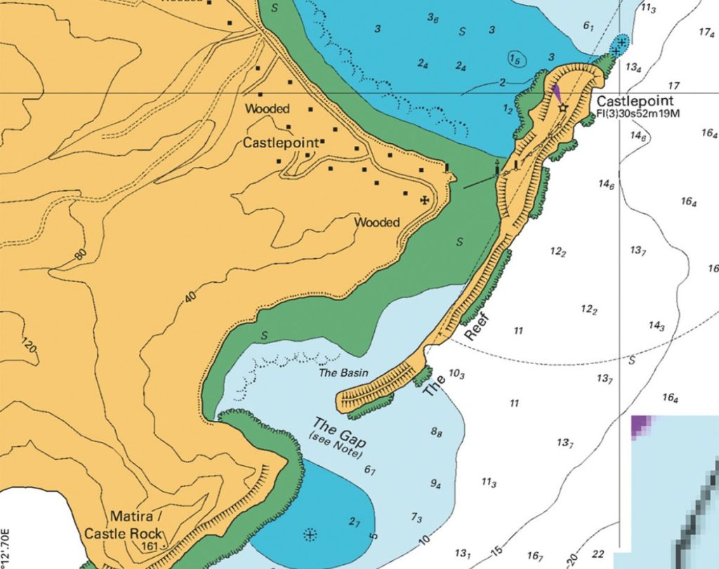
Our nautical curiosity about Castlepoint was piqued far away, in the Marlborough Sounds; where, as part of a circumnavigation of Te Ika a Maui, the North Island, and half of Te Wai Pounamu, the South Island, we met some wonderful characters. One loquacious and cheerfully eccentric skipper, hearing that we were heading up the Wairarapa coast next, suggested an emergency haven at Castlepoint; to be precise, through The Gap (where people surf) and into The Basin (very shallow), and behind the suspiciously low parts of The Reef (where waves crash over First Gap and Lovers’ Bow). Err… From his description, we found that all a bit hard to believe. When the time came, we sailed right on past.
But Lesley was intrigued enough for us to make the landward trip back to the unique landmark that is Castlepoint with her camera – and certainly didn’t come away convinced of the anchorage story. Here’s why:
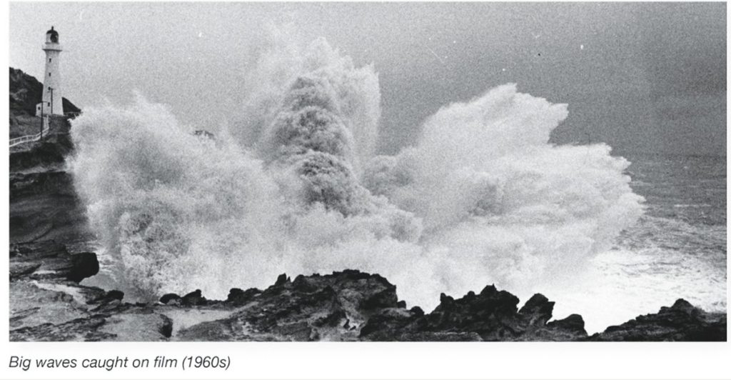
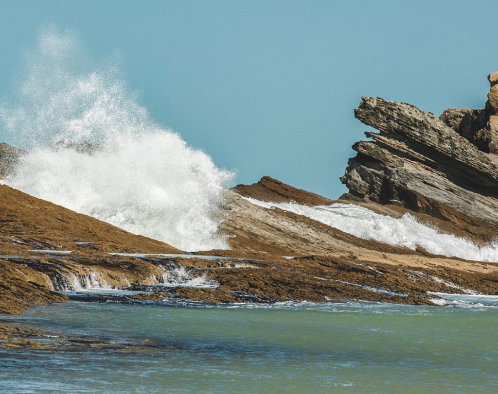
Many pictures will show that the wave action at Castlepoint is especially dramatic, with huge swells often bursting over the narrow rim of the ridge that supposedly protects The Basin, or surfers enjoying the Gap, or those rugged Wairarapa coast fishing boats launching and retrieving through that same serious surf. And yet, there is a long and rich history of Castlepoint being a landfall destination, a harbour for coastal shipping, and a place for boating of various kinds.

First, there’s the legend of the great Polynesian voyaging ancestor of Māori people, Kupe, who chased a trickster wheke (octopus) all the way from the homeland of Hawaiki. The octopus finally holed up in a cave at Castlepoint. Yes, the cave is real, and it’s still there, just below the lighthouse (I’m not so sure about the octopus). It’s called Te Ana-o-te-wheke-a-Muturangi (the cave of Muturangi’s octopus); and once the Ngāti Kahungunu iwi established a settlement there, the place was called Rangi-whakaoma. So naturally, there would have been many comings-and-goings of various types of waka from this indent in an otherwise unforgiving coastline.
Then the distinctive outcrop was re-named by the British navigator James Cook in 1770, “presumably,” says Te Ara the online encyclopaedia of New Zealand, “because the landform resembled a fortress.” Te Ara’s potted history continues: “In 1843 the missionaries William Williams and William Colenso stepped ashore, followed five years later by Thomas Guthrie, who established a sheep and cattle run. Until the early 20th century, Castlepoint was Wairarapa’s main port.”
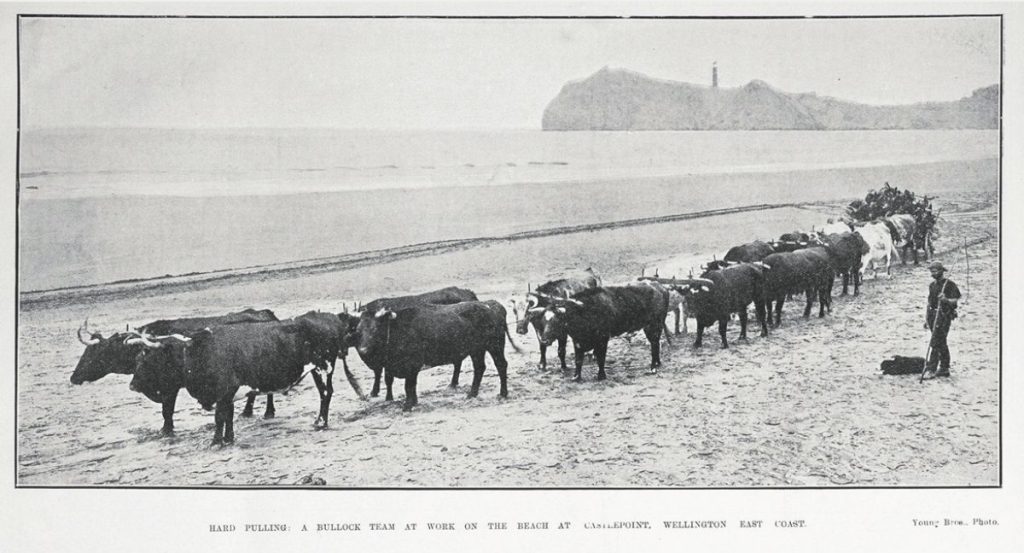
I find it hard to think of Castlepoint as a ‘port;’ and this was certainly not a convincing or permanent appellation. Although it did have a long jetty built out into the northern bay behind the lighthouse, used mainly for the loading of wool bales (exports) and grog, groceries, building materials, and kerosene for the light (incoming). But it couldn’t last. And so it came to be that “…improved roading led to the port’s decline and eventual closure.”
The full history of the place can be found in the splendid and comprehensive book Castlepoint, by Alex Hedley, Nan and Peter Laing. It’s in the library but out of print and commanding a good price in the desirable pre-loved books market. The book focuses as much on the huge Castlepoint station, an iconic New Zealand sheep-rearing operation. And the also-famous Castlepoint horse races along the northern beach that leads to Ngatamatea Reserve, Sandhill, and Spottie Rocks.

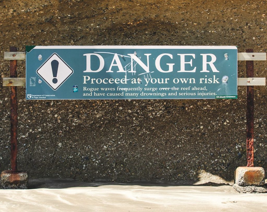
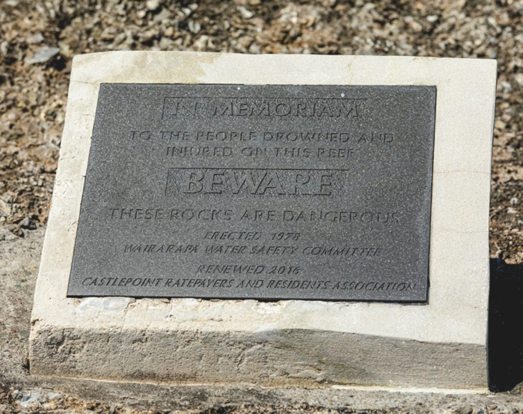
Given the nature of the stern coastline – there’s no harbour to speak of between Napier and Wellington – it’s understandable that the solidity of the land is as much a part of the history of this once-was-a-seaport. So as an Up the Creek adventure, this is more about surviving, or getting safely out of the creek. Or the relative security of the land. For, since 1849, 31 vessels have foundered there, and 31 lives have been lost.
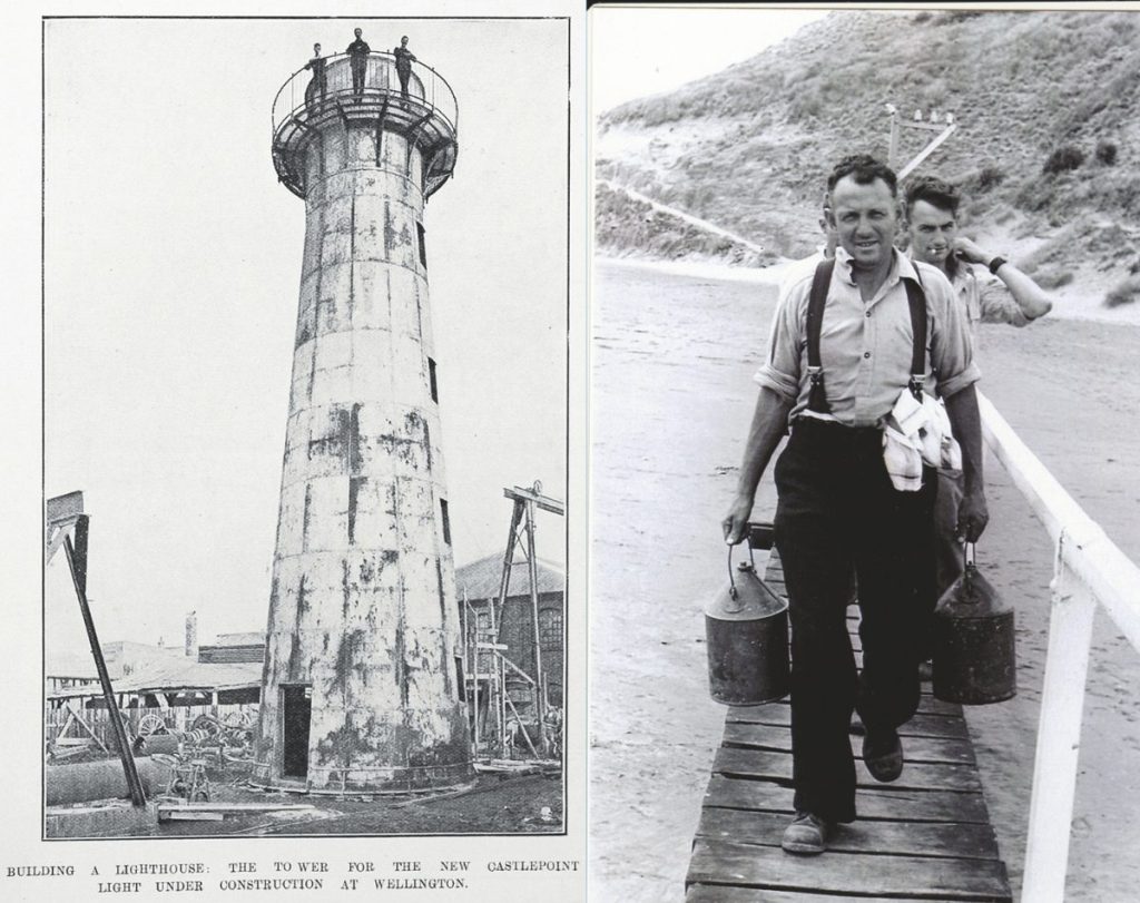
That’s why, in 1913, a 23m-high lighthouse was built on Castlepoint reef. Well, not actually built on site. It was of an innovative pre-fab design comprising curved sections; and was first test-assembled in Wellington, then taken apart, and the kitset transported here and put together again. It is New Zealand’s third-highest lighthouse and sends three flashes every 45 seconds, visible for 30km.
It’s also New Zealand’s most colourful lighthouse, being lit up with changing coloured LED lights from the landward side (a community group’s initiative). It has its own website, which carries a live-feed camera recording of conditions at the rock, day or night. [See More Information panel]. Every evening the outside of the lighthouse is lit up after sunset until midnight. The coloured lights show comes every 15 minutes, followed by a period of white light.
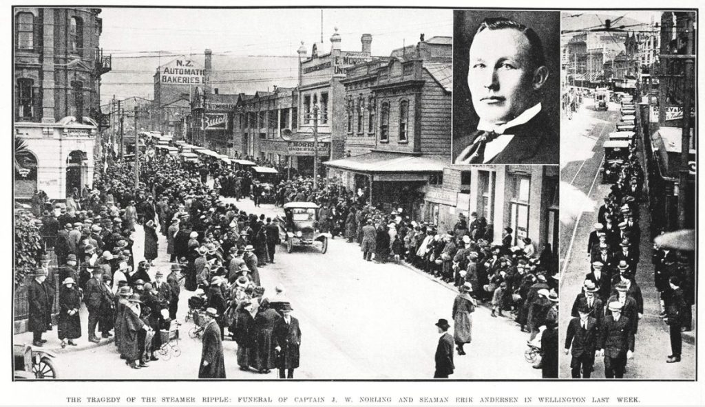
The Castlepoint light arrived too late to save two notable shipwrecks – the White Swan, carrying a load of politicians from Auckland to Wellington in 1862, and the Sovereign, wrecked at Mataikona in 1894.
The rocks and platforms of Castlepoint reef – with names like The Ladder, The Dock, Shakey, Blowhole, High Top, Craigy, Herring Rock, First Wire, Second Wire – are also a precarious place for off-the-rocks fisherfolk. Many have been swept away, as a memorial plaque reminds us. The seals that come ashore in the same places seem OK with it, though.
A good gig—sort of
For lighthouse keepers, when we still had them, Castlepoint was a desirable posting for Marine Department crews, as so many lighthouses are in seriously remote places. At Castlepoint there was a small township, with a store, a hotel, and a school.
Still, there were tough times. In 1922 the head keeper died, falling from the tower. Locals say his ghost remains but is a benign presence. The serious 1942 earthquakes caused some damage: the lenses tipped out of their mercury bath, and the mercury spilled on the floor. As for structural damage to the tower, there wasn’t much, though experts were called in to assess how much it had shifted during the shocks.
In the 1950s the lighthouse was converted from kerosene to diesel, with a generator at the end of Jetty Road, and wires carrying electricity to the tower. Then the Wairarapa Electric Power Board provided reticulated power to the area for the first time in the early 1960s.
In 1988 Grant Hitchcliff, the last keeper, signed off for the last time when the New Zealand lighthouses network became automated. The lighthouse is now controlled by a computer in Wellington.
Natural history
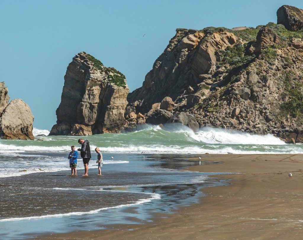
Castlepoint is made of successive, sometimes alternating, layers of lime- and sandstone, deposited over the last two million years, so you could say it’s quite new in geological terms. Like limestone elsewhere, an agglomeration of embedded fossils is visible. On the outside towards the sea, the reef sits on an older base of siltstone. As an emerging coastline – sometimes with its movement accelerated by earthquakes – the softer mudstone all around has been eroded, revealing the harder limestone. This would account for the caves and holes. The offshore reef is also limestone. The long, straight-ish shape of the landform is a result of faults that run on either side.
On a more ephemeral scale, the location is the only place in the world to find the rare Castlepoint daisy (Brachyglottis compactus).
Beach races
Regular events, with horse races and other community competitions, have been held on Castlepoint’s long northern beach since the late 19th century. The vibe of the events is summarised in Alex Hedley’s book. “From the time when it was a prominent stopover for deserters, sailors and travellers, Castlepoint was a place to meet, to be bawdy, but most of all, sociable. As well as a drinker’s and gambler’s haven, the wide, hard stretches of sand at Castlepoint provided an ideal arena for sporting rivalry to flourish. Thomas Guthrie was a keen promoter of sport, which included running, jumping, shotput, the hammer throw, shooting, and beach cricket. To celebrate the end of a day’s competition, the main beach, and often the shorter beach beside the cave, would play host to folk dances by moonlight, whimsical concertina, and the occasional sword dance.”
Looking at photos of the races through the years (including a photo essay by celebrated photographer Brian Brake), it’s clear from the quality of horseflesh and the smart attire of obviously seasoned jockeys that these were real racing events.
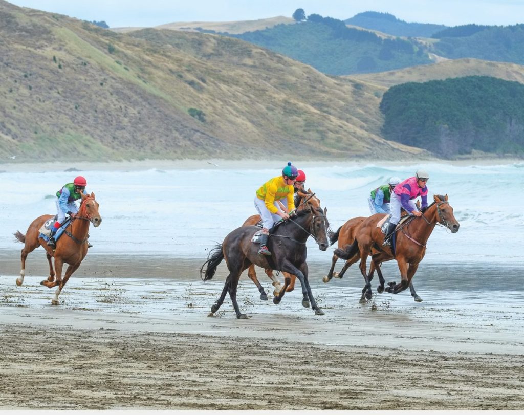
Mike Simms, in his book Sand, Sea and Hoofbeats continues, “The races in the early days were a masculine affair – fights on the beach were not uncommon. Even some of the women were fairly tough. One is said to have had a baby in the afternoon and played the accordion at the landing-shed dance that night.”
The races are still going strong, an annual event held in March.
Better maps needed, or at least new will do
Now here’s an intriguing mariners’ note: as we sailed up there, we noticed large parts of the Wairarapa coastline remain uncharted. A strip all along the coast, averaging a nautical mile wide from the shore, is mostly a blank white on the charts, with only occasional and approximate locations of rocks, a very few depth soundings, and bounded by a dotted line. It carries the bland statement ‘Unsurveyed (see Note).’
This, all the way from Tokoratau Reef, just north of Cape Palliser, to Hinemahanga Rocks, just south of Cape Kidnappers. This, in New Zealand in 2025 (!)
Naturally, as passing sailors cautiously keeping well offshore, we wondered why. What gives?
I did my research and found lurking the dark hand of politics. Apparently it’s a leftover legacy of the neoliberal policies of a previous New Zealand government, who decreed it wasn’t the Navy’s role to attend to or finish that particular job, charting the coastline for the safety of all mariners. Something instead for private enterprise. But private enterprise never did. No visible profit, you see.
We wonder if, with an overlay of modern chart-plotter and depth-sounder records, which exist in fulsome detail (though in many different places), and the input of the local iwi and fishing people (who surely must know exactly where the rocks are), the coast here can finally be properly charted. A kind of nautical citizen science project for the common good. Just a thought …
Worthy visit
If not an always-inviting inlet, Castlepoint remains a fascinating place to visit. For a start, it’s a photographer’s dream with dramatic land- and seascapes aplenty. The lighthouse, the annual beach horse races, the remarkable surf-launching fishing boats, the unique interdenominational church St Peters by the Sea (owned by a trust of Anglican, Presbyterian and Catholic churches), seals, seabirds, epic swells, and unusual rock formations just about everywhere – your lens will never run short of worthwhile subjects.
There’s the surfing too, of course, with a post-briny visit to Castlepoint Hotel – locals call it ‘The Whakataki’ (the introduction) – being de rigueur. Hearty meals guaranteed. And there’s a country golf course nearby.
On the road to Castlepoint – perhaps on your way to the races – you’ll be driving down the valley of the Whakataki River, to the once-was port of the Wairarapa. It’s a place with seafaring stories aplenty, only one that now needs a different, more cautious kind of visit. Still, you won’t regret going there. In a word, it’s memorable.
Further information
Aratoi – Wairarapa Museum of Art & History
https://www.aratoi.org.nz/
Castlepoint Holiday Park & Motels
Richard & Megan Hewitt https://castlepoint.co.nz/
Castle Point Lighthouse
https://castlepointlighthouse.com/
DOC Castlepoint Scenic Reserve – outlining local walks
https://www.doc.govt.nz/parks-and-recreation/places-to-go/wairarapa/places/castlepoint-scenic-reserve/
Maritime New Zealand – lighthouses listing
https://www.maritimenz.govt.nz/public/lighthouses-of-new-zealand/castle-point
Masterton Wairarapa Memories Facebook Page
https://www.facebook.com/groups/304466449206832
Whakataki Hotel
https://www.castlepointhotel.co.nz/
Wairarapa Archives
https://www.mstn.govt.nz/recreation/wairarapa-archive
Books
Castlepoint – Coastal Station and Settlement, by Alex Hedley, Nan and Peter Laing, 2010, Hedleys Books
Castlepoint – The story of life on an iconic New Zealand sheep and cattle station, by Lorain Day, 2011, Harper Collins.
Sand, Sea and Hoofbeats, by Mike Simms, 1972, Masterton and Castlepoint Racing Club.
The Lighthouse construction
The light tower was built in Wellington in mid-1912, by S Luke and Company in Victoria Street of curved cast iron plates. The bottom ring is 5.4m wide, the top one is 3m, with each of the seven rings also being 3m high. They thought the pre-fabrication would take just a month. Which proved a tad optimistic.
Beyond that, the lighthouse’s composition is exotic, reflecting the technological tenor of the time. That is, components had to be imported from Europe. The lenses were made by Barbier, Benard & Turenne in Paris; the lens turning apparatus by James Milne and Son, of Edinburgh, Scotland; and the lantern, which is the glass part and the dome, was made by James Dove and Co, also of Edinburgh. To minimise friction, the lenses turned in a mercury bath. The light itself – originally fuelled by kerosene carried across the sands by the lighthouse keeper and his team – came from Chance Brothers, of Birmingham in the UK.
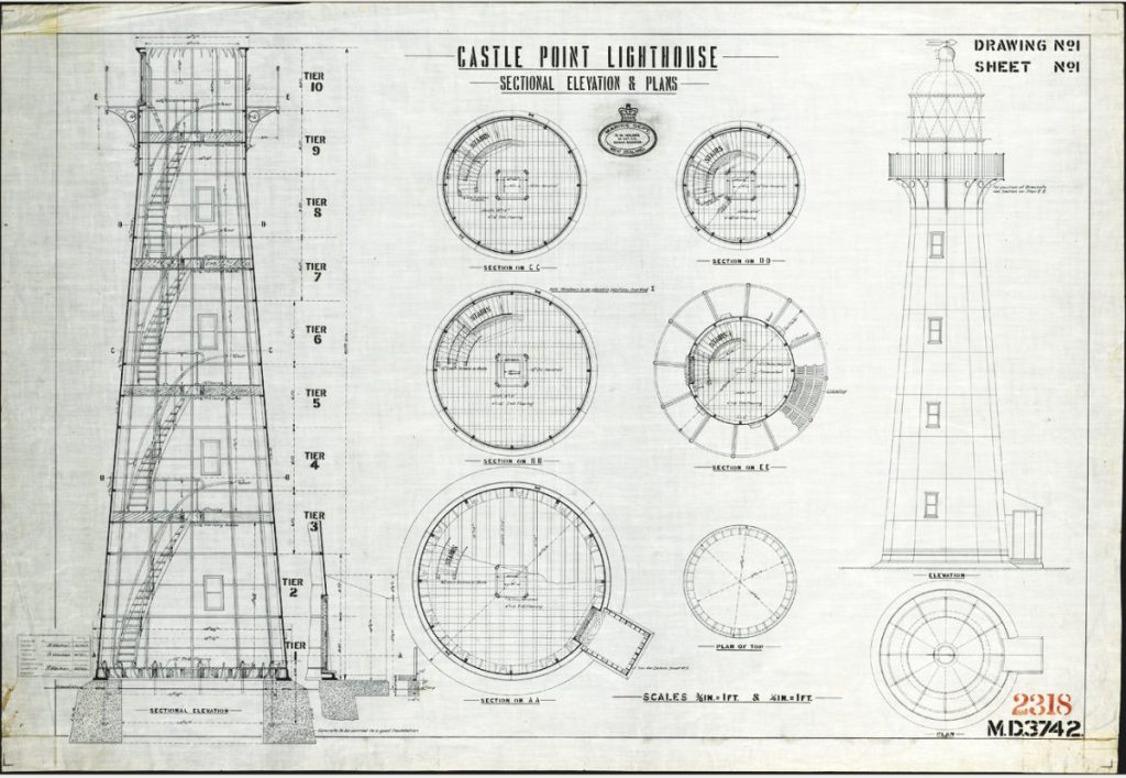
The kitset lighthouse was shipped to Castlepoint and landed at the old jetty. A team of horses pulled the components up a specially-built track to the site. The Ministry of Works oversaw the building of the lighthouse and installed a spiral staircase with internal platforms.
It was officially lit for the first time on Sunday January 12, 1913, sending out a triple flash every 45 seconds that could be seen for 35kms.
Timeline of the light
2013 Castle Point lighthouse centenary
2003 Original lighthouse coating removed & epoxy urethane system applied.
1988 Lighthouse fully automated & lighthouse keeper withdrawn.
1977 Optic roller bearing replaced with slew ring.
1970 Lighthouse keepers reduced from two to one.
1961 Lighthouse connected to mains electricity.
1953 Electric turning motors & lamp installed – 230V from diesel generator.
1947 Tower shakes in storm, so foundation bolts tightened.
1946 Optic mercury bearing / float replaced with roller bearing.
1942 Earthquakes cause optic bearing float to spill mercury.
1934 Lantern room cleaning path installed (this was missing from original tower).
1923 Number of Lighthouse Keepers reduced from three to two.
1922 Principal keeper Duncan fell to his death from a ladder while fixing telephone line.
1913 Signal station with telegraph connected. Light first lit and operational (total cost £9,703).
1912 Tower cast at Lukes & Co Wellington (cost of tower – £1,375).


